
By Aslam Khan
All terrain features are derived from a complex landmass known as a mountain or ridge line and the very same concept is used in studying mounds of land in landscaping.
Absolute knowledge of terrain is a must for landscaping:
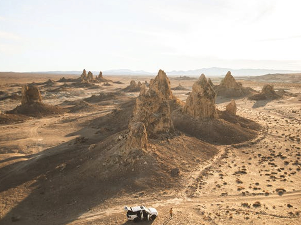
Thumb rules: The five major terrain features are: Hill, Ridge, Valley, Saddle, and Depression.The three minor terrain features are: Draw, Spur and Cliff.
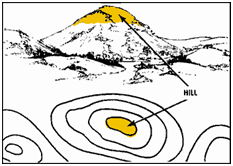
Hill: A hill is an area of high ground in round shape. If we look from a hilltop, the ground slopes down in all directions. A hill is shown on a map by contour lines forming concentric circles. The inside of the smallest closed circle is the hilltop.

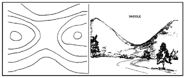
Saddle:A saddle is a dip point or low point between two areas of higher ground. If you are in a saddle, there is high ground in two opposite directions and lower ground in the other two directions. A saddle is normally represented as an hourglass.

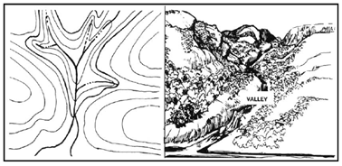
Valley: A valley is formed by streams or rivers. A valley begins with high ground on three sides. If standing in a valley, three directions offer high ground, while the fourth direction offers low ground. Contour lines forming a valley are either U-shaped or V-shaped. The closed end of the contour line (U or V) always points upstream or toward high ground.

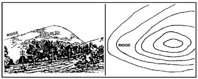
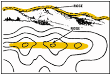
Ridge: A ridge is a sloping line of high ground. If you are standing on the centerline of a ridge, you will normally have low ground in three directions and high ground in one direction with varying degrees of slope. If you cross a ridge at right angles, you will climb steeply to the crest and then descend steeply to the base. Contour lines forming a ridge tend to be U-shaped or V-shaped. The closed end of the contour line points away from high ground or pointing downhill. The term ridgeline is not interchangeable with the term ridge. A ridgeline is a line of high ground, usually with changes in elevation along its top and low ground on all sides of a land mass.
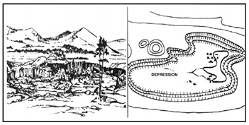
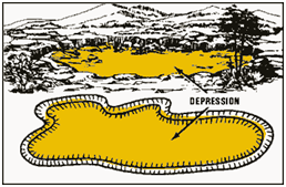
Depression: A depression is a low point in the ground. It could be described as an area of low ground surrounded by higher ground in all directions, or simply a hole in the ground. Depressions are represented by closed contour lines that have tick marks pointing toward low ground.
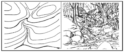
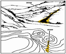
Draw: A draw is a less developed stream course than a valley. In a draw, there is essentially no level ground and, therefore, little or no maneuver room within its confines. If you are standing in a draw, the ground slopes upward in three directions and downward in the other direction. A draw could be considered as the initial formation of a valley. The contour lines depicting a draw are U-shaped or V-shaped, pointing toward high ground.
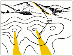
Spur: A spur is a short, continuous sloping line of higher ground, normally jutting out from the side of a ridge. A spur is often formed by two rough parallel streams, which cut draws down the side of a ridge. The ground sloped down in three directions and up in one direction. Contour lines on a map depict a spur with the U or V pointing away from high ground.

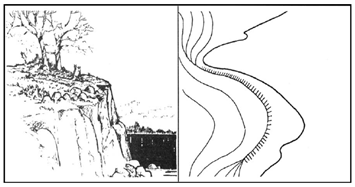
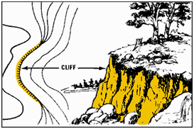
Cliff: A cliff is a vertical or near vertical feature; it is an abrupt change of the land. When a slope is so steep that the contour lines converge into one “carrying” contour of contours, this last contour line has tick marks pointing toward low ground. Cliffs are also shown by contour lines very close together and, in some instances, touching each other.
That’s how we name and recognize each part of the uneven and complex land terrain before setting out plan of any type of construction in the open space. The landmass could be naturally occurring on site or can be created by applying the concept of terrain mapping.
Thus unsettled nature can be settled again by studying them from close quarters at micro-level.
Copyright © 2025 JD Institute of Fashion. All Right Reserved
Designed by